15 Vatnajokull Facts That Will Surprise You
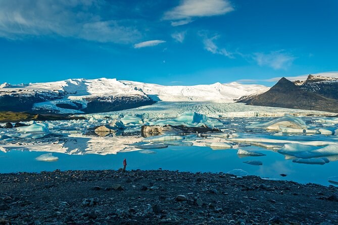
The short answer. Vatnajökull is young, huge and shrinking fast. It formed after Iceland was settled, it hides seven volcanoes, and it has lost more than 15% of its volume in a century. The lagoon everyone photographs did not exist a hundred years ago. You can see most of what follows on one of the Vatnajokull national park tours.
The size of it
1. It covers about 7% of Iceland
The ice cap measured around 7,500 km² in 2023, around 7% of the country. Every glacier in Iceland together covers about 10%.
2. It is still Europe’s largest ice cap by volume
Even after a century of losses, no ice cap in Europe holds more ice. A three-hour hike from Skaftafell puts you on one of its outlet glaciers.
3. Seven volcanoes lie under it
The ice hides seven active central volcanoes. Four of them, including Öræfajökull, are among the most active in Iceland.
What that means for your visit: you are never walking on the ice cap itself on a hike, but on one of its tongues, which reach down from the high plateau to the lowlands. A snowmobile tour rides higher up, at the end of a mountain road.
It is younger than you think
4. It is not left over from the Ice Age
The great ice sheet that covered Iceland 20,000 years ago melted away. The park says Vatnajökull is not a remnant of it. In the warmest stretch, 5,000 to 8,000 years ago, probably only small glaciers were left on the highest mountains.
5. Trees grew where the ice now lies
Tree logs found in front of two outlet glaciers are dated to about 2,000 years ago. The valleys under them were free of ice then.
6. It joined into one ice cap around the time Iceland was settled
Separate glaciers on the high ranges merged 1,000 to 1,500 years ago. By the settlement, around 874, they formed a single ice cap.
7. It was biggest only about 130 years ago
The southern outlets reached their largest size of the last 10,000 years at the end of the 19th century. Farms named in the sagas, east of Öræfajökull, were buried under advancing ice in the 17th and 18th centuries.
Stand at the edge of an outlet glacier today and you are looking at ice that has been shrinking, not growing, for your whole lifetime and your grandparents’.
Fire under the ice
8. An eruption renamed a whole district
In 1362 the volcano under Öræfajökull erupted in the largest pumice eruption in Iceland’s recorded history. The district was renamed Öræfi, wasteland. It erupted again in 1727.
9. A ridge 7 km long is buried under the ice
An eruption under the glacier in 1996 built a ridge of hyaloclastite rock 7 km long. The ice now covers it.
The lagoon that should not be there
10. Jökulsárlón did not exist a century ago
At its most advanced, Breiðamerkurjökull came within about 250 metres of the sea. Lakes only began to appear in front of it in the 1930s, as the ice pulled back.
11. The lagoon sits in a trough up to 300 metres deep
The glacier carved a trough 200 to 300 metres deep and 25 km long. The lagoon is its mouth, and it is the largest and most active glacial lake in Iceland.
You can see it without walking on any ice. The lagoon day from Reykjavík stops there for about 80 minutes, and the lagoon kayak paddles among the icebergs from age 14.
If you hike on Falljökull from Skaftafell, you walk on a tongue of ice that flows down from the caldera of Öræfajökull, the volcano of 1362.
Rivers, roads and a bridge to nowhere
12. The ring road was only finished in 1974
Glacial rivers cut off the farms south of the ice cap until 1974, when the last river on Route 1 was bridged. Before that, horses were the main way across.
13. Iceland’s longest bridge crossed a river that left
The Skeiðará river moved into another channel in 2009. The longest bridge in Iceland, built over it, has since been dismantled. The outwash plain it crossed is probably the largest in front of any active glacier in the world.
14. Some outlets surge at 100 times their normal speed
Surge-type glaciers lurch forward for months at a time, moving up to 100 times faster than usual. Up to 75% of the ice cap’s area is affected by surging outlets.
When you drive Route 1 across the black sands west of Skaftafell, you are crossing ground that glacial floods from under the ice have built up over thousands of years.
The ice is going
15. It could lose half of its volume by 2100
Most of Iceland’s glaciers began to retreat after 1890, and since 2000 the outlet glaciers have pulled back exceptionally fast. The park expects them to lose half their volume by 2100.
At Skaftafell you can see it on foot. The mountain Hafrafell stood inside the ice in 1940; now it divides two glaciers. The S1 trail passes numbered markers that explain the retreat as you walk.
The facts in one table
| Figure | Value | Why it matters |
|---|---|---|
| Area in 2023 | around 7,500 km² | About 7% of Iceland |
| Volume lost in a century | more than 15% | The outlets retreat every year |
| Volcanoes under the ice | Seven | Floods and eruptions shape the plains |
| Lagoon trough | 200 to 300 metres deep | The lagoon keeps growing |
| World Heritage since | 5 July 2019 | For fire and ice together |
How to see these facts with your own eyes
You can check most of this list in one day. Walk the S1 trail at Skaftafell and you see fact 15 on the ground, with Hafrafell standing clear of the ice. Drive east and you cross the plain from fact 13. At the lagoon you are standing at the mouth of the trough from fact 11, watching fact 10 happen as the glacier calves. And on a guided hike, you put your crampons on the ice that fact 7 says was at its largest when your great-grandparents were young.
Seeing it for yourself
- From the ice: a guided hike from Skaftafell, the lowest fare $104.
- From the shore: the lagoon and its trails, free beyond the parking fee.
- From inside: an ice cave in the cold months, from $157.
The national park page tells the story of the ice in full, things to do lists the free trails, how to get there covers the drive, and the weather page shows what each month brings. Where to stay lists the towns and farms near each base.
See the ice, the lagoon and the cave
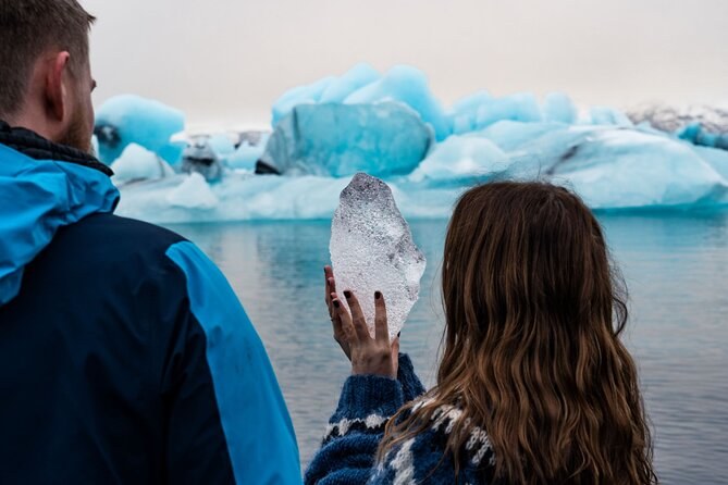
Guided Glacier Lagoon and Diamond Beach Day Trip from Reykjavik
Fourteen and a half hours from Reykjavík by coach to the iceberg lagoon, the black beach and two waterfalls. You see the ice from the shore; no walk on it.
From $185 per person
Check Availability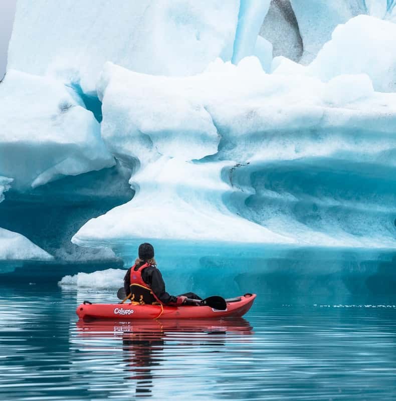
Jökulsárlón Glacier Lagoon Kayaking Tour
An hour and a half among the icebergs in a sit-on-top kayak, with a two-piece suit and a guide, from the lagoon car park; from age 14.
From $157 per person
Check Availability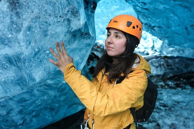
Ice Cave Tour in the National Park of Vatnajökull
Three hours from the lagoon car park in a modified 4x4, with about an hour on the glacier and inside an ice cave the guide picks that day.
From $157 per person
Check AvailabilityNext: plan a family day on the ice, in minimum ages and boot sizes. Every fare sits side by side on Vatnajokull Tours.