What You See on a Vatnajokull Glacier Hike, Feature by Feature
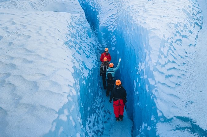
The short answer. On a hike you cross the gravel the glacier left, step onto grey ice at the snout, and climb among crevasses, moulins, ice arches and blue walls. Each one is the glacier moving or melting, and a guide reads them for you. The glacier hike tours at Skaftafell show you all of it in three to five hours.
The route, zone by zone
| Zone | What you see | What it tells you |
|---|---|---|
| The moraine | Gravel ridges and grey rivers | Where the ice has been |
| The snout | Dirty ice and your first crampon steps | The glacier is melting here |
| The lower tongue | Ridges and meltwater channels | The ice is flowing downhill |
| The crevasse field | Deep cracks, blue walls, ice arches | The ice is stretching |
| The melt zone | Moulins and running water | Water is reaching the bed |
How far up you get depends on the tour. Adria_F counted about two hours on the ice out of a three-and-a-half-hour hike; the five-hour Tröll hike spends much longer on it.
Before the ice: moraines and glacial milk
The walk begins on rubble. Rocks and gravel frozen into the ice scrape the bed as the glacier moves, and the ice drops them at its sides and front as moraines. On the S1 trail at Skaftafell you can walk through this ground without a guide and see kettle holes where buried ice melted out. The rivers you cross are grey with fine silt, which the park calls glacial milk.
Many outlet glaciers now end in a lake. The park names those in front of Svínafellsjökull and Skaftafellsjökull as the textbook case: small pools join into a long lake between the moraine and the ice, and the lake grows as the front thins and breaks up.
The snout: grey ice and your first steps
The lowest ice is dirty. A glacier carries debris on its surface and inside it, so the ice near the snout looks grey or black rather than white. This is where the guide checks your crampons and you practise walking in them before the climb. Gwen_S found the guide also used a rope to take the group up and down the steep bits.
The lower tongue: how the ice moves
A glacier is snow pressed into ice, and the ice flows downhill under its own weight like dough, the park says. On southern Vatnajökull the line where snow gain equals melt sits at about 1,000 to 1,200 metres. Below it, as on every tongue you hike, the glacier loses more ice each year than it gains. That is why the ice you walk on is old, hard and full of channels cut by meltwater.
Crevasses: why they open, and how deep they go
Crevasses are cracks that open where the ice is stretched as it flows over a bump or round a bend. The park’s glaciologists say the weight of the ice closes them at about 30 metres, and the deepest pass that. Where water runs in, it acts like a wedge and can split the glacier through to the bed.
They are often hidden under snow, and many only show in late summer. That is the guide’s job: to know which surface holds. Neil_B was struck by how many more dangers the glacier held than its surface showed. On the five-hour Tröll hike, Stephanie_P abseiled a short way down into one.
Moulins: the shafts to the bed
In the melt zone some crevasses turn into moulins, round shafts where a meltwater stream drops into the glacier and on down to the bed. The guide decides how close you go. Glacier mills, the older name for moulins, are among the sights on the Blue Ice Discovery hike.
Blue ice and ice arches
The blue is physics. Ice reflects blue light and absorbs the red and yellow, while air bubbles reflect all of it and look white. So the densest ice, squeezed free of bubbles, glows the deepest blue. You see it on fresh crevasse walls and under arches where meltwater has hollowed out the ice.
In the cold months the guides take some groups into caves in the ice. On one Jökulsárlón hike, Corinna’s guide took the group into a cave that was in fact a moulin, by a longer route, to give them more time inside. Caves are never promised: the guides pick a safe one each day, if there is one.
Hidden things to look for
- Lateral moraines. Gravel ridges high on the valley sides mark the edge of the ice at its largest, only about 130 years ago.
- Debris in the ice. Rock and grit frozen into a crevasse wall are on their way to the moraine.
- The sound of water. Stop and listen for streams under your feet.
- The highest peak. On a clear day Hvannadalshnjúkur shows in the distance from the Skaftafell hikes.
Where the ice comes from
Everything you walk on fell as snow, high on the ice cap. The park explains that a glacier is mostly compressed snow. Year after year, snow piles up faster than it melts. The grains under it are squeezed into firn, and the firn into solid ice. That ice then creeps downhill to the tongues, where you meet it.
So when you stand on an outlet glacier, you stand on old snow that has finished its journey. The blue of a fresh crevasse wall is that snow with the air pressed out of it. Your guide may point up to where the ice cap begins, far above the icefall.
How the ice changes through the year
The same outlet looks different in each season. In winter and spring, snow covers much of the surface and hides the crevasses, which is why a guide chooses the line. By late summer the snow has melted off the tongue and many crevasses show clearly. That is when the blue walls are easiest to see.
If you want caves, come in the cold months. If you want the open crevasse fields, late summer shows them best. The weather page gives the rain and temperature for each month.
Photographs on the ice
You can photograph freely, and the guides often take pictures for you. Keep a wrist strap on your phone: a dropped phone in a crevasse stays there. Ask before you step back for a picture: the guide knows where the edge is.
Which hike shows you the most
A short hike reaches the snout, the lower tongue and the first crevasses. The four-and-a-half-hour hike spends about four hours on the glacier with eight people at most, from age 14. The ice-climbing hike adds a blue wall to climb. The national park page explains how the outlet glaciers formed, and things to do covers the trails that reach the ice edge without a guide. For what to wear, see the visitor guide, and for the months, when to visit.
See it for yourself: hikes that go further up
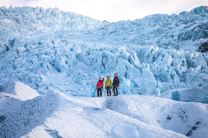
Glacier Adventure From Skaftafell - Small Group Tour
Four and a half hours with eight people at most, a minibus to the ice and about four hours on it with a certified guide; from age 14.
From $230 per person
Check Availability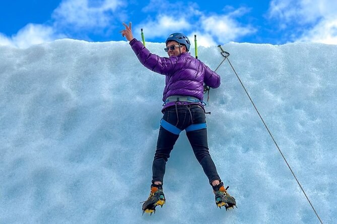
Skaftafell Ice Climbing & Glacier Hike
Four hours from the Tröll base: a hike onto the ice and a climb up a blue ice wall, with boots in the fare and six people at most; from age 12.
From $256 per person
Check Availability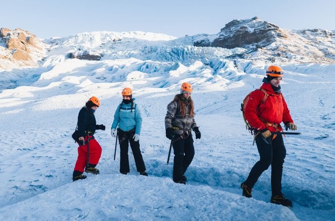
Blue Ice Discovery – Guided Glacier Hike from Skaftafell
Three and a half hours from the guides' lodge at Skaftafell: a bus to the foot of the ice, crampons and axe, and a hike with 15 at most; from age 10.
From $107 per person
Check AvailabilityNext: find out why the ice is shrinking, in facts the ice does not tell you. Every fare sits side by side on Vatnajokull Tours.